K12
Valentine Road
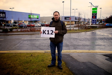

K12
Valentine Road
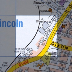
This grid includes the Tritton Road retail parks around Valentine Road and Crusader Road....
This week we find ourselves in the grim environs of the Tritton Road retail park district of Lincoln, specifically the Valentine Road area around Next, Asda Home and The Range. But, after a depressing walk around the retail sheds and car parks, we find a shining light in the form of the Red Cross office and we find out about the history of the area. All this, plus another round of A Question of Lincoln... to listen to the podcast, click on the player below.


ABOUT LINCOLN ATOZ


FOLLOW US ONLINE:

LISTEN TO US LIVE!
EVERY MONDAY
9PM-10.30PM ON
HOW
YOU
CAN GET
INVOLVED!


EXPLORE
THE MAP


Perhaps we should leave the last word on this grid to our resident poet Tref...
It’s January and everywhere is dark and wet and miserable.
The Lincoln slate sky covers a time of drabness day,
Flat blue-red-brick- beige-grey-dark in the paint-damp-run drizzle,
Orange branding tries vainly to B&Q brighten the desperate place,
Over the neon road, lights just make it though the gloom:
SCS, Pets at Home, Starbucks, Staples, Comet, PC World, Currys
Countrywide conformity reflected in dark and miserable grey.


The History of K12
by Joanna Hughes of the Lincolnshire Archives
This area was originally rural, much of it within Boultham parish. Being close to the River Witham the land is low-lying and liable to flooding, leaving it undeveloped for many centuries. Document at the Lincolnshire Archives show how, in the early nineteenth century, Lord Monson drained much of this land to created fields; early maps show these neat rectangular enclosure and also some clay pits, which would have provided the clay to make bricks for the new buildings Lincoln needed as it expanded. Some of those channels cut to drain the original landscape can still be seen today as you travel along Tritton Road into Lincoln.
The industrial age changed this area completely with the arrival of the railways. The Midland, Great Eastern, Great Northern and Great Central Railway companies all converged just north of this grid square, making Lincoln an industrial hub with connections to the rest of the country. Along with this labyrinth of railways, there also appeared all the necessary engine sheds, warehouses and sidings that came with them. You can still see some of these today around Morrison’s and the University.
Foundries moved into this area to make use of the proximity to the rail links, with William Foster & Co being one of the largest. Foster’s made all manner of agricultural machinery, from traction engines to pea-shelling machines, as can be seen from the engineering plans and drawings held at the Lincolnshire Archives. The range and scale of Foster’s output, along with those of the other great Lincoln foundries, show just how important Lincolnshire’s agricultural and industrial role was in helping to feed and mechanise an ever- growing population. With the advent of two mechanised wars in the early twentieth century, Lincoln’s industrial know-how really came into its own, with the development of the tank being one of the city’s greatest achievements.
Easier access was now needed to all these railways, warehouses, goods yards, foundries and factories etc. Dixon Street and Tritton Road, as we know them today, are relative newcomers to Lincoln’s road network, with High Street still being the main route into the city from the earliest times (Moorland Avenue offered another pre-Tritton alternative in the first half of the 20th century).
Because of this and the increasing traffic on High Street, in 1925 Dixon Street, (originally a cul de sac off High Street), was extended west to cross the River Witham, instantly opening up a useful alternative route to the west side of the city via Ropewalk, an area now taken up with the University roundabout and the St Mark’s Retail Park. (Can any Siren FM listeners remember having to turn down Boultham Park Road, under the railway bridge, left onto Coulson Street to get up onto Ropewalk, before Tritton Road was fully completed to run alongside Valentine Road in the 1980s?).
Tritton Road itself was named after Sir Tritton, an engineering expert in agricultural machinery, who worked for William Foster & Co. Ltd for many years, eventually becoming managing director in 1939. He also had a key role in the development of the tank in World War II. Look out for his blue plaque in Morrison’s, near the site of one of his factories.
Just as the railways and foundries helped serve Lincoln’s (and the country’s) growing Victorian population and their increasing need for food, materials and mechanisation, so the area around Valentine Road today is continuing to meet our retail and leisure requirements with major department stores, supermarkets, bowling, restaurants and fitness centres.
(C) 2013 Lincoln AtoZ | Contact us