S7
Bunkers Hill & The Carlton Centre


S7
Bunkers Hill & The Carlton Centre
This grid includes Bunkers Hill, Outer Circle Road, The Carlton Centre, Venables Way, Carlton Boulevard, part of St Giles....
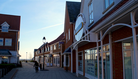
After a painful and inevitably failed attempt to cycle up Lindum Hill, we find ourselves amongst the “Young Professionals” of the new-build Carlton Boulevard area and The Carlton Centre. Here, we find out about the mining past of the area, Jonny rails against “Drive Thru’s”, and we decide to risk our cash at the Carlton Centre’s betting shop in the hope of procuring a new toaster from the local Argos. All this, plus the latest round of A Question of Lincoln. Click the player below to listen to the podcast...


ABOUT LINCOLN ATOZ


FOLLOW US ONLINE:

LISTEN TO US LIVE!
EVERY MONDAY
9PM-10.30PM ON
HOW
YOU
CAN GET
INVOLVED!


EXPLORE
THE MAP


The History of S7
by Joanna Hughes of the Lincolnshire Archives
Before all the industrial and buildings and houses appeared this area was quite sparsely populated. A large part lay within the parish of Greetwell, whilst some of the area was termed as “Extra-parochial” on early maps. This meant it didn’t lay within the jurisdiction of a particular parish. Originally, before the 19th century, much of the area would have been farmed as large open fields. Then, in the eighteenth and nineteenth century the Enclosure Act came into force and across the country, the large fields and common land were gradually divided up into the smaller rectangular fields we are more familiar with. It’s fascinating to consider that some of today’s modern housing plots may still follow the line of some of these much earlier enclosures.
A reminder of the rural character of this area is the pub now known as The Lincolnshire Poacher, on Bunker’s Hill (no doubt named after the Battle of Bunker’s Hill – a battle in the American War of Independence which took place in Massachusetts in 1775). This was originally a farmhouse which would have stood somewhat isolated on its eminence above this agricultural landscape.
As well as farming, this area has been extensively mined and quarried for its valuable limestone and iron ore deposits from the earliest times until very recently. The mining and quarrying was on a large scale – so much so it needed its own tramway, which is shown on some of our nineteenth maps at The Archives. Some of these tramways even connected with the mainline railways, which helped Lincoln develop its commercial role substantially.
Much of the limestone used for the construction on Lincoln’s uphill buildings came from these quarries. The mining and quarrying past in this area can be seen in the dips and hollows which lie below the level of some of the roads, upon which much of the area’s industrial and commercial premises have been built.
As today’s shops, showrooms, supermarkets and other retail units overlay much of the area and its earlier industrial heritage, those areas which have not been built on, like Greetwell Quarry to the south of the Carlton Shopping Centre, after centuries of being exploited by Man, are now being used for recreation; as Nature begins to reclaim what was hers, it’s once more becoming an important ecosystem for local flora and fauna as well as providing a pleasant open green space in the city for local residents.
(C) 2013 Lincoln AtoZ | Contact us